Browse Items (51 total)
Sort by:
The South Holston Dam in Tennessee
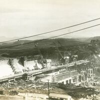
This first set of pictures show the South Holston Dam while it is being constructed. The third picture shows the completed reservoir that forms after the dam is complete. The South Holston Reservoir is located on the South Fork of the Holston River…
Dam at Cove Creek
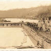
This photo shows the construction of what was originally known as the Cove Creek Dam, later renamed Norris Dam in honor of Senator George Norris, who was a strong supporter of the TVA. The image captures progress on the dam during its development…
Pamphlet, "Oak Ridge, Tennessee: The Atomic City"
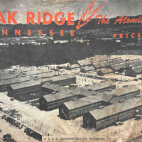
A single pamphlet from 1945 advertising Oak Ridge, TN with photographs and facts. Facts include data about schools, hospitals, transportation and much more in the area. Photographs depict the landscape and buildings of Oak Ridge as well as people and…
Pamphlet, "Housing for Clinton Engineer Works"

A pamphlet advertising the forms of housing that families of different dynamics had available to them, including information on utilities, community services, transportation, stores and shops, medical services, and recreation.
The SOCM Sentinel March 1983

A newsletter for club members discussing accomplishments, new laws proposed that the effects the club, updates from county chapters, and information about upcoming fundraising opportunities
1982 SOCM Annual Report
A report disclosing all achieved by the different SOCM chapters and the organization as a whole from the previous year, newspaper clippings featuring issues the club dealt with, leadership, and financial reports
1986 SOCM Annual Report
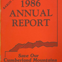
A report disclosing all achieved by the different SOCM chapters and the organization as a whole from the previous year, the club leadership, and the financial reports
The TVA Region Map
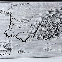
This photo is a black-and-white illustrated map depicting the Tennessee Valley Authority (TVA) region across parts of Tennessee, Kentucky, Alabama, Georgia, North Carolina, and Virginia. The map highlights major cities, rivers, and TVA dam sites. The…
TVA Location of Dams and Reservoirs
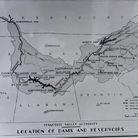
A map illustrating the location of existing, under construction, and recommended dams and reservoirs within the Tennessee River system. Notable sites include Norris, Wheeler, Wilson, and Pickwick Landing Dams. The map was originally featured in the…
TVA Norris Quadrangle Topographic Map
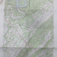
A TVA 1929 topographic map of the Norris Quadrangle, revised and published in 1973. Lists roads, public areas, Norris dam, cemeteries, and more.