Browse Items (51 total)
Sort by:
Resort and Recreation on Development of the Upper TN Basin
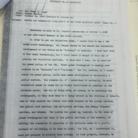
Planning the Tennessee Valley as a recreational and conservation-focused region, not just an industrial one.
TVA Location of Dams and Reservoirs
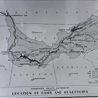
A map illustrating the location of existing, under construction, and recommended dams and reservoirs within the Tennessee River system. Notable sites include Norris, Wheeler, Wilson, and Pickwick Landing Dams. The map was originally featured in the…
The South Holston Dam in Tennessee
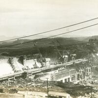
This first set of pictures show the South Holston Dam while it is being constructed. The third picture shows the completed reservoir that forms after the dam is complete. The South Holston Reservoir is located on the South Fork of the Holston River…
TVA Norris Quadrangle Topographic Map
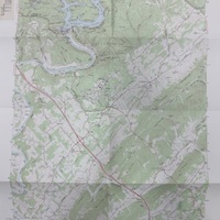
A TVA 1929 topographic map of the Norris Quadrangle, revised and published in 1973. Lists roads, public areas, Norris dam, cemeteries, and more.
Norris Lake Marina
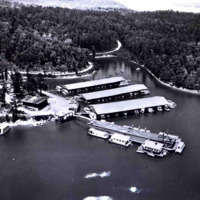
This aerial photo of Norris Lake shows how the area changed after Norris Dam was built in 1936. Land that was once forests, farms, and small communities was flooded to create the lake. The shoreline is now used for marinas and recreation instead of…
Norris Dam
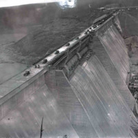
This photo shows the face of Norris Dam and its power facilities, highlighting the scale of the structure and the control it exerts over the river. Built in 1936, the dam turned a natural waterway into a managed system for electricity and flood…
Norris Dam
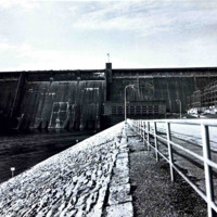
This photo, taken in 1981, shows Norris Dam, originally built in 1936 by the Tennessee Valley Authority. By this time, the dam had long transformed the area, flooding the original river valley to create Norris Lake. The structure represents both…
SOCM Logo

Screenshot of the current website of SOCM containing their new logo
Great Smoky Mountains National Park Map
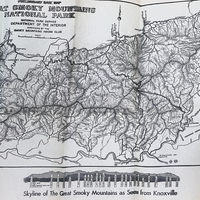
At the end of the Smoky Mountains Hiking Club handbooks, there is a map of the National Park
Message from O. K. Sergeant (President of the Smoky Mountains Hiking Club)
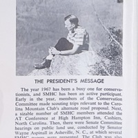
A message from O.K. Sergeant, the president of the Smoky Mountains Hiking Club in 1968 on the year and the efforts that club members are making for conservation of the parks.